The Burning Amazon
Friday, October 4th, 2019October 4, 2019
Since the beginning of winter in South America (summer in the Northern Hemisphere), more than 200,000 wildfires have struck the Amazon rain forest of Brazil, Bolivia, Paraguay, Peru, and Venezuela. Some 30 million acres (12 million hectares) of wilderness have been lost in the fires, causing incalculable damage to the environment. The unusually severe fire season was blamed on winds and high temperatures as well as the ancestral practice of chaqueo (slash-and-burn farming). But many fires were thought to have been illegally set to clear land for large corporate agriculture, logging, and mining interests. Blame also fell on lax policing and the weakening of the environmental protection system in Brazil, where most of the fires occurred.
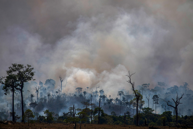
On Aug. 27, 2019, smoke rises above charred trees in the Amazon rain forest of northern Brazil. Credit: © Joao Laet, AFP/Getty Images
Forest fires are common in the Amazon during the dry season, from July to October. The fires are sometimes caused naturally by lightning strikes and exacerbated by drought, but most of the recent fires were probably started by people wanting to clear the land for other uses. There has been a vast increase in large, intense, and persistent fires along major roads in the Amazon, for example, something inconsistent with the randomness of lighting strikes. Climate change too is making the fires worse, as dry seasons in the Amazon become ever dryer, hotter, and longer.
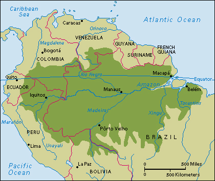
Click to view larger image
The Amazon rain forest covers much of northern South America. About two-thirds of the rain forest lies in Brazil. Credit: WORLD BOOK map
The fires (and the fire starters) have received divided attention in the Palácio do Planalto, the official workplace of the president of Brazil in Brasília, the capital. There, President Jair Bolsonaro has decreased environmental protections since taking office in January 2019, allowing an increase in deforestation—both legal and illegal, and always a problem—in the Amazon. Bolsonaro too has refused much international aid to help fight the fires, which continue to burn and destroy large portions of the rain forest. Bolsonaro eventually deployed some 44,000 soldiers to help the understaffed firefighters in the rain forest, and he agreed to coordinate firefighting efforts with other Amazonian countries. At the end of August, after the fires had raged for months, Bolsonaro also announced a 60-day ban on the legal setting of fires to clear land.

Deforestation results in the loss of vast areas of tropical rain forest each year. This photograph shows an area of the Amazon rain forest in Brazil that has been destroyed as part of slash-and-burn agriculture. In this method, farmers cut down trees and burn them. The ashes enrich the soil for only a brief period before the nutrients are depleted. The farmers then clear another area of forest. Credit: © Julio Etchart, Alamy Images
All seven Brazilian states that include parts of the Amazon have experienced sharp increases in fire activity in 2019. Numerous wildfires are also consuming alarming amounts of rain forest in the Amazonian regions of Bolivia, Paraguay, Peru, and Venezuela. The massive number of wildfires has greatly increased emissions of toxic carbon monoxide and the greenhouse gas carbon dioxide, a leading contributor to global warming. Smoke from the fires has obscured skies and aggravated such health problems as asthma, bronchitis, and chronic obstructive pulmonary disease (COPD) in people throughout the region.