National Native American Heritage Month: Cultural Areas of Indigenous Americans
Wednesday, November 8th, 2023

Indigenous peoples of the Americas: cultural areas
Credit: World Book map
People in the United States observe Native American Heritage Month each year in November. During this period, many Native tribes celebrate their cultures, histories, and traditions. It is also a time to raise awareness of the challenges Indigenous people have faced in the past and today, along with their contributions to the United States as its first inhabitants.
Indigenous peoples of the Americas are the first people who lived in North America or South America, and their descendants. Indigenous means original or native. Indigenous people had been living in the Americas for thousands of years before any Europeans arrived. They formed hundreds of tribes with many different ways of life.
Scholars called anthropologists, who study human culture, classify the hundreds of North American Indigenous tribes into groups of tribes with strong similarities. These groups are called culture areas. The culture areas of Canada and the United States are (1) the Arctic; (2) the Subarctic; (3) the Northeast, often called the Eastern Woodlands; (4) the Southeast; (5) the Plains; (6) the Northwest Coast; (7) California; (8) the Great Basin; (9) the Plateau; and (10) the Southwest.
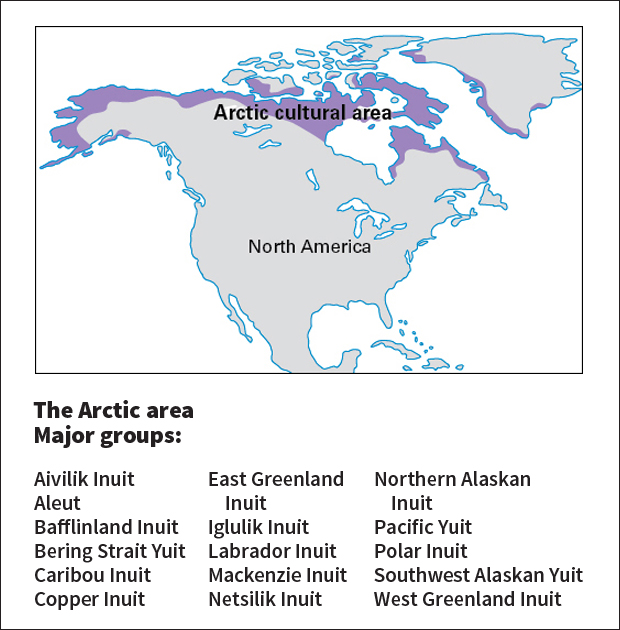
Arctic cultural area
Credit: World Book map
Most Arctic peoples lived in small bands along the seacoast, moving often in search of food. Seals were the primary food. Sealskin was widely used for making shelters and boats, clothes, tools, and other goods. Arctic peoples adapted to the modern world while preserving much of their traditional way of life.
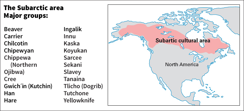
Subarctic cultural area”
Credit: World Book map
The Subarctic was thinly populated. Tribes consisted of small bands, related through marriage. Food was often scarce, and the people moved about hunting and gathering wild plants, berries, and nuts. Most Subarctic peoples live in areas set aside for them, called reserves in Canada and reservations in the United States.
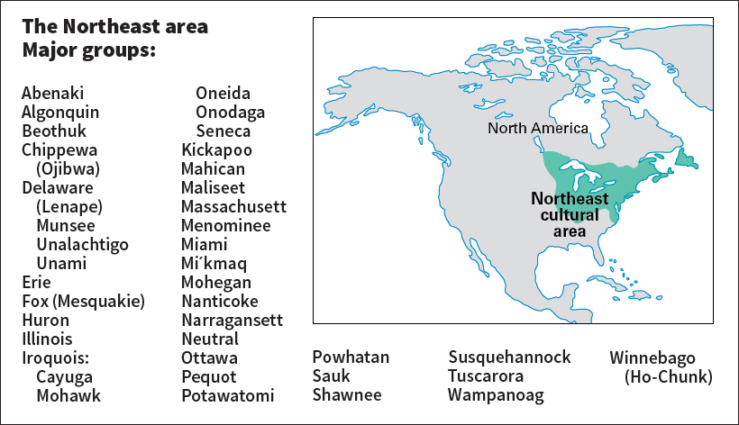
Northeast cultural area
Credit: World Book map
In the Northeast, the Iroquois and most Algonquian groups lived mostly by growing corn, beans, and squash. Some of the northernmost groups depended more on hunting, gathering, and fishing. Many tribes now live in Oklahoma and various Western states. Many Iroquois became leaders in the struggle for the rights of Indigenous people in Canada and the United States.
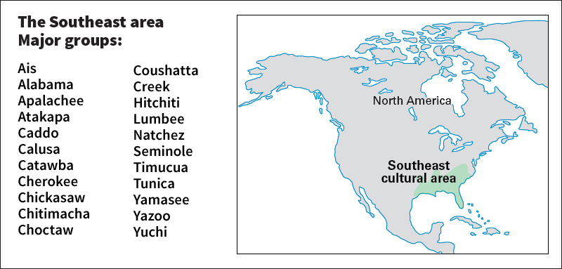
Southeast cultural area
Credit: World Book map
The adequate rainfall and long growing season enabled Southeastern peoples to grow large quantities of corn. They traveled either on foot or in wooden dugout canoes. Women had much power and influence among most Southeastern groups. Today, Southeast tribes try to maintain a balance between traditional and modern ways of life.
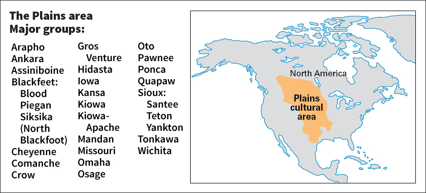
Plains cultural area
Credit: World Book map
When the Spaniards brought the horse to the Plains in the 1600’s, a new way of life appeared. On horseback, the Plains peoples could follow the great herds of buffalo. Nearby tribes, and those forced westward by the advancing white people, quickly adopted the Plains way of life. Communication across tribes led to the development of the Plains sign language.
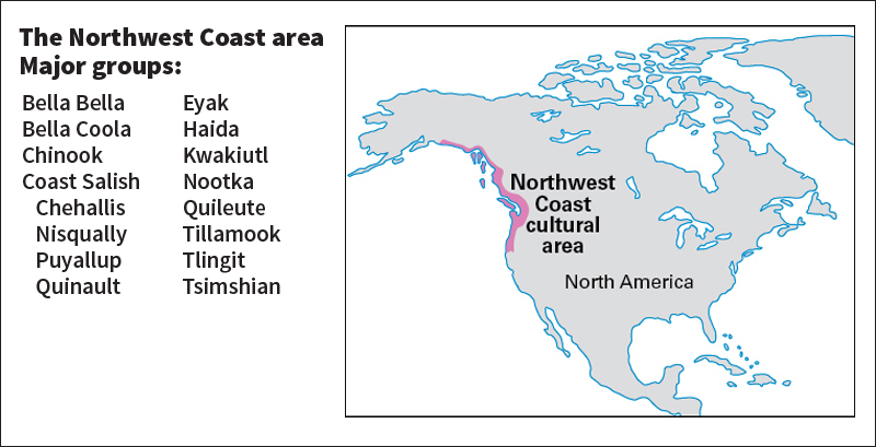
Northwest Coast cultural area
Credit: World Book map
Among tribes of the Northwest Coast, a few families had great influence in each village because of their ancestry and wealth. Totem poles, carved from tree trunks, became more common with the iron tools brought by the white traders. Totem poles showed the social rank and ancestry of a family or individual.

California cultural area
Credit: World Book map
Tribes in the California area consisted of one or a few villages of extended families. Acorns were the most important food. Women gathered acorns, washed them, and pounded them into flour. The women then cooked the flour to make acorn mush or bread. The Pomo were famous for their basket making.
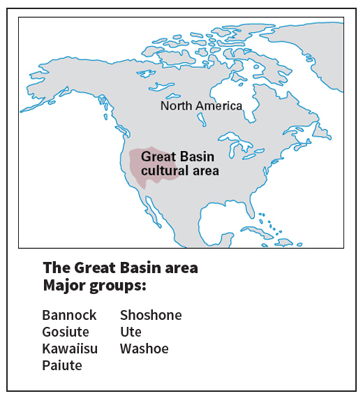
Great Basin cultural area
Credit: World Book map
The tribes of the Great Basin consisted of many small bands. Each band had a home territory near a lake or a stream that provided a reliable supply of water and fish. Pine nuts were the most important single source of food. Today, many Indigenous people of the Great Basin live as ranchers and farmers.
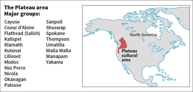
Plateau cultural area
Credit: World Book map
The tribes living in the Plateau consisted of bands of extended families. During the summer, bands traveled their territory in search of food. In the winter, they lived in villages. Plateau peoples mainly ate wild bulbs and roots, berries, and salmon and other fish. Today, many Plateau peoples live on reserves or reservations.
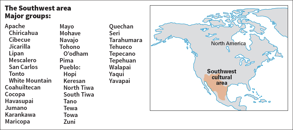
Southwest cultural area
Credit: World Book map
The early peoples of the Southwest included several tribes. The Pueblo tribes had one of the most highly developed civilizations in North America. They were excellent craftworkers. Most Pueblo lived in villages and farmed along rivers that provided water for irrigation. The Navajo, a hunting and gathering tribe, are today one of the largest Indigenous groups in the United States. The Navajo have become noted for weaving blankets and rugs and making silver jewelry.