Behind the Headlines – World Book Student
  • Search

  • Archived Stories

    • Ancient People
    • Animals
    • Arts & Entertainment
    • Business & Industry
    • Civil rights
    • Conservation
    • Crime
    • Current Events
    • Current Events Game
    • Disasters
    • Economics
    • Education
    • Energy
    • Environment
    • Food
    • Government & Politics
    • Health
    • History
    • Holidays/Celebrations
    • Law
    • Lesson Plans
    • Literature
    • Medicine
    • Military
    • Military Conflict
    • Natural Disasters
    • People
    • Plants
    • Prehistoric Animals & Plants
    • Race Relations
    • Recreation & Sports
    • Religion
    • Science
    • Space
    • Technology
    • Terrorism
    • Weather
    • Women
    • Working Conditions
  • Archives by Date

Posts Tagged ‘south america’

« Older Entries

International Sloth Day

Thursday, October 20th, 2022
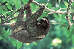
The sloth is an animal that uses its claws to hang from branches. Credit: © Michael Fogden, Bruce Coleman, Inc.

The sloth is an animal that uses its claws to hang from branches.
Credit: © Michael Fogden, Bruce Coleman, Inc.

Slow down and wait a minute! Today is International Sloth Day, a day to slow our speed and appreciate the world’s slowest mammal. While many species evolve to eat more, sloths have done the opposite! They evolved in a way that allows them to eat less and survive just by slowing down.

A sloth is a mammal that has a slow and peculiar way of moving. Sloths spend nearly all of their time in rain forest trees in Central and South America, where they travel upside down, hanging from branches with their hooklike claws. Hanging upside down requires almost no energy for a sloth. They can fall asleep in this position and may even stay suspended in the trees for some time after they die. There are two main groups of sloths. One is two-toed and the other is three-toed.

All sloths have small heads, and their noses are blunt. They have peglike teeth. Two-toed sloths also have large sharp teeth at the front of the mouth. Both measure 15 to 30 inches (38 to 76 centimeters) long and weigh 5 to 23 pounds (2.3 to 10.5 kilograms). Their long, coarse fur grows in the opposite direction as that of other mammals, from the stomach towards the back. This allows rain water to easily drain off the body as the sloth hangs. The fur ranges from grayish to brownish in color, which makes them hard to see among the branches.

Sloths turn green in the rainy season from algae that grows in their fur. This helps the sloth blend into the rain forest and protects it from large birds of prey, such as the harpy eagle, and big cats. Sloth fur also provides a home to a variety of invertebrates (animals without backbones) — some of which are found nowhere else on earth. A single sloth can host more than 100 moths and other insects within its fur.

Sloths get little energy from their diet, feeding mostly on leaves. Two-toed sloths may also eat fruits and flowers. They need relatively little food and have a lower rate of metabolism than do other mammals of similar size. Metabolism is the process by which living things turn food into energy. In order to save energy, sloths do not regulate their body temperature like other mammals. They have a lower body temperature than most mammals, which varies with the environmental conditions.

A sloth can take up to 30 days to digest a single leaf. As a result, they have a constantly full stomach. Sloths climb down to the forest floor to defecate (eliminate wastes) about once a week. They can lose up to a third of their body weight in one sitting. Sloths are surprisingly good swimmers. During the rainy season they can swim about three times faster than they can move on the ground.

Although commonly grouped together, the two types of sloths are actually very different animals with very different lifestyles. Two-toed sloths are slightly larger, more active, have a broader diet, and are generally faster-moving than the three-toed sloth. They have brown hair with a long, pinkish, piglike snout. Three-toed sloths have gray hair, a white face and a dark mask around the eyes. Two-toed sloths are primarily active at night, while three-toed sloths are active throughout the day and night. Although almost all mammals possess seven cervical (neck) vertebrae as standard, sloths are one of the few mammals that do not. Two-toed sloths retain only five to seven cervical vertebrae, while three-toed sloths have eight or nine. This unusual trait enables three-toed sloths to turn their head through 270 degrees. This allows them to look for predators and to see the world right side up, while hanging upside down. Sloths can live up to about 30 years.


Tags: algae, animals, central america, mammals, rain forest, sloth, south america, three-toed sloth, two-toed sloth
Posted in Animals, Current Events | Comments Off

Stupendemys the Titanic Turtle

Monday, March 30th, 2020

March 30, 2020

Some 15 million years ago, long after the non-bird dinosaurs and the beasts they lived alongside had gone extinct, giant creatures still walked (or swam) the Earth. Recently, the discoveries of a team of scientists led by Edwin Cadena of Del Rosario University in Colombia have been putting more of a face—or a shell, in this case—on one of these ancient giants. And, not only did the giant have a shell, but the shell had spikes! Meet Stupendemys, the titanic turtle.

Stupendemys lived during the Miocene Epoch, around 23 million to 5.3 million years ago. Giant turtle illustration of Stupendemys geographicus credit: © Jaime Chirinos

Stupendemys lived during the Miocene Epoch, around 23 million to 5.3 million years ago. credit: © Jaime Chirinos

The giant aquatic (water-dwelling) Stupendemys had a big head with a sharp beak. It had four paddlelike limbs and a short tail. It probably could not withdraw its head or limbs into its large shell, as can many turtles. Its shell alone measured about 8 feet (2.4 meters) long. Stupendemys weighed about 2,500 pounds (1,150 kilograms). It and the prehistoric marine turtle Archelon were the largest turtles known to have ever lived.

Stupendemys had been known since the 1970’s from huge pieces of shells and limb bones, but no cranial (skull) material had been positively identified. Cadena’s new trove of Stupendemys fossils included skull fragments, however. Found in Colombia and neighboring Venezuela, the skull pieces matched those of previously unidentified ancient turtle remains discovered in other parts of South America, showing that Stupendemys was fairly widespread.

Some­ of the Stupendemys shells found by Cadena and his team had large forward-pointing horns at the shoulders. The scientists believe this is a case of sexual dimorphism. Sexual dimorphism is a difference in body size or shape between males and females of the same species. Males probably used these horns in combat over mates and territory. Deep gouges were often found near the Stupendemys shell horns, suggesting that males literally locked horns when fighting.

Stupendemys was not the top boss of South American waterways during the Miocene Epoch, a time in Earth’s history that lasted from 23 million to 5.3 million years ago. The turtle was likely a gentle giant, surviving on a diet of hard-shelled mollusks, fruits, and seeds. And its huge size did not grant it complete protection from predators. Giant crocodilians prowled the region at that time, including the 40-foot (12.5-meter) giant caiman Purussaurus. One Stupendemys shell found by Cadena’s team contained an embedded crocodilian tooth! It’s hard to say who came out on top in that encounter, but it was likely an epic struggle.

Tags: archelon, colombia, dinosaurs, paleontology, south america, Stupendemys, turtle, venezuela
Posted in Animals, Current Events, History, People, Prehistoric Animals & Plants, Science | Comments Off

The War of the Triple Alliance

Friday, February 28th, 2020

February 28, 2020

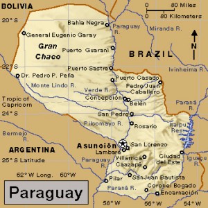
On March 1, 1870, 150 years ago this Sunday, Paraguay’s President Francisco Solano López was killed by Brazilian troops in the Cerro Corá valley of northeastern Paraguay. López’s death marked the end of the War of the Triple Alliance (also called the Paraguayan War), the bloodiest war in Latin American history. The conflict had begun in 1864 and pitted Paraguay against the nearby nations of Argentina, Brazil, and Uruguay—the “Triple Alliance.” Paraguay lost the war, its population was decimated, and much of the country was destroyed.

Francisco Solano López. Last portrait. credit: Public Domain

This is the last known photograph of Paraguayan President Francisco Solano López. He was killed 150 years ago this Sunday on March 1, 1870. credit: Public Domain

It is a grim anniversary, but the War of the Triple Alliance still calls forth nationalistic pride in many Paraguayans. The country is marking the sesquicentennial of the end of the war with concerts, book launches, and conferences in Asunción, the capital, as well as special commemorations in the capital and at López’s death site along the Aquidabán Niguí River.

In 1862, as the United States struggled through a bloody Civil War, Paraguay’s first president, Carlos Antonio López, died after 21 years in power. His son, Francisco Solano López, then took over as a president with dictatorial powers. Francisco believed that Argentina and Brazil wished to occupy Paraguay and Uruguay, so he signed a defense treaty with Uruguay. In 1864, Paraguay went to war against Brazil to defend Uruguay’s government. After Argentina refused to let Paraguayan troops cross its territory to attack Brazil, López declared war on Argentina as well. In 1865, Brazil helped a new government take hold in Uruguay, which joined with Argentina and Brazil to form the Triple Alliance against Paraguay.

Paraguay credit: World Book map; map data (c) MapQuest.com, Inc.

Paraguay fought the nearby countries of Argentina, Brazil, and Uruguay (to the southeast, not on the map) in the War of the Triple Alliance (1864-1870). credit: World Book map; map data (c) MapQuest.com, Inc.

After initial Paraguayan victories, the turning point of the war came at the 1866 Battle of Tuyutí in southwestern Paraguay. In the bloodiest battle ever in South America, some 17,000 soldiers were killed at Tuyutí—most of them Paraguayan. A series of desperate battles followed as the Alliance armies gained the upper hand. By January 1869, Alliance troops had captured Asunción and controlled much of Paraguay, but López and a stalwart group of soldiers continued fighting a guerrilla campaign in the mountains. (Guerrilla warfare is conducted by roving bands of fighters who stage ambushes, sudden raids, and other small-scale attacks.) Brazilian troops eventually caught up with López and his remaining forces in the Cerro Corá valley, where the war ended with López’s death on the battlefield in 1870.

The war left Paraguay in ruins. Some historians estimate that the country lost about 60 percent of its prewar population, including nearly 90 percent of its men. In total, an estimated 400,000 people died in the conflict. Paraguay also lost a fourth of its territory. After the war, power struggles among rival political groups plagued the country. More than 30 presidents headed Paraguay’s government from 1870 to 1932.

Tags: argentina, Asunción, brazil, Francisco Solano López, paraguay, paraguayan war, south america, uruguay, war of the triple alliance
Posted in Current Events, Disasters, Education, Government & Politics, History, Military, Military Conflict, People | Comments Off

The Burning Amazon

Friday, October 4th, 2019

October 4, 2019

Since the beginning of winter in South America (summer in the Northern Hemisphere), more than 200,000 wildfires have struck the Amazon rain forest of Brazil, Bolivia, Paraguay, Peru, and Venezuela. Some 30 million acres (12 million hectares) of wilderness have been lost in the fires, causing incalculable damage to the environment. The unusually severe fire season was blamed on winds and high temperatures as well as the ancestral practice of chaqueo (slash-and-burn farming). But many fires were thought to have been illegally set to clear land for large corporate agriculture, logging, and mining interests. Blame also fell on lax policing and the weakening of the environmental protection system in Brazil, where most of the fires occurred.

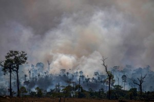
Smokes rises from forest fires in Altamira, Para state, Brazil, in the Amazon basin, on August 27, 2019. - Brazil will accept foreign aid to help fight fires in the Amazon rainforest on the condition the Latin American country controls the money, the president's spokesman said Tuesday. Credit: © Joao Laet, AFP/Getty Images

On Aug. 27, 2019, smoke rises above charred trees in the Amazon rain forest of northern Brazil. Credit: © Joao Laet, AFP/Getty Images

Forest fires are common in the Amazon during the dry season, from July to October. The fires are sometimes caused naturally by lightning strikes and exacerbated by drought, but most of the recent fires were probably started by people wanting to clear the land for other uses. There has been a vast increase in large, intense, and persistent fires along major roads in the Amazon, for example, something inconsistent with the randomness of lighting strikes. Climate change too is making the fires worse, as dry seasons in the Amazon become ever dryer, hotter, and longer.

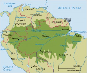
Click to view larger image Amazon rain forest covers much of northern South America. About two-thirds of the rain forest lies in Brazil. The rain forest also occupies parts of several other countries. Credit: WORLD BOOK map

Click to view larger image
The Amazon rain forest covers much of northern South America. About two-thirds of the rain forest lies in Brazil. Credit: WORLD BOOK map

The fires (and the fire starters) have received divided attention in the Palácio do Planalto, the official workplace of the president of Brazil in Brasília, the capital. There, President Jair Bolsonaro has decreased environmental protections since taking office in January 2019, allowing an increase in deforestation—both legal and illegal, and always a problem—in the Amazon. Bolsonaro too has refused much international aid to help fight the fires, which continue to burn and destroy large portions of the rain forest. Bolsonaro eventually deployed some 44,000 soldiers to help the understaffed firefighters in the rain forest, and he agreed to coordinate firefighting efforts with other Amazonian countries. At the end of August, after the fires had raged for months, Bolsonaro also announced a 60-day ban on the legal setting of fires to clear land.

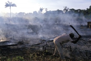
Deforestation results in the loss of vast areas of tropical rain forest each year. This photograph shows an area of the Amazon rain forest in Brazil that has been destroyed as part of slash-and-burn agriculture. In this method, farmers cut down trees and burn them. The ashes enrich the soil for only a brief period before the nutrients are depleted. The farmers then clear another area of forest. Credit: © Julio Etchart, Alamy Images

Deforestation results in the loss of vast areas of tropical rain forest each year. This photograph shows an area of the Amazon rain forest in Brazil that has been destroyed as part of slash-and-burn agriculture. In this method, farmers cut down trees and burn them. The ashes enrich the soil for only a brief period before the nutrients are depleted. The farmers then clear another area of forest. Credit: © Julio Etchart, Alamy Images

All seven Brazilian states that include parts of the Amazon have experienced sharp increases in fire activity in 2019. Numerous wildfires are also consuming alarming amounts of rain forest in the Amazonian regions of Bolivia, Paraguay, Peru, and Venezuela. The massive number of wildfires has greatly increased emissions of toxic carbon monoxide and the greenhouse gas carbon dioxide, a leading contributor to global warming. Smoke from the fires has obscured skies and aggravated such health problems as asthma, bronchitis, and chronic obstructive pulmonary disease (COPD) in people throughout the region.

Tags: amazon rain forest, bolivia, brazil, deforestation, disasters, peru, south america, wildfires
Posted in Animals, Conservation, Crime, Current Events, Disasters, Environment, Government & Politics, Health, Natural Disasters, People, Plants | Comments Off

Super/Natural Textiles

Friday, March 8th, 2019

March 8, 2018

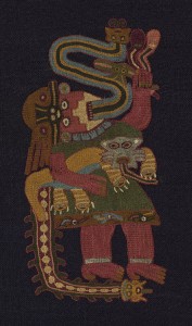
In February, an exhibition called “Super/Natural: Textiles of the Andes” opened at the Art Institute of Chicago. The exhibition features numerous textiles (woven fabrics) and other items created by the ancient Andean cultures of South America. These textiles were traditionally worn as clothing, but they also were used for communication and artistic and religious expression among the diverse peoples of the desert coasts and mountain highlands of the Andean region.

The detail illustrated here is one of over 50 brightly colored figures neatly embroidered in orderly rows that decorate a dark indigo blue mantle, or cloak. Each figure holds a small feline whose striped legs identify it as the pampas cat, a powerful predator and protector of agricultural fields. The individual appears to channel otherworldly power, as streamers emerge from his mouth and down his back, suggesting that the figure embodies the supernatural forces believed to govern the natural world. Made by the Paracas, a southern coastal community that flourished in Peru from about 500 BC to AD 200, this type of figure appears throughout the Andes and across artistic media.  Credit: Mantle (detail) (100 BC/AD 200), Wool embroidered in stem stitches by Paracas Necropolis; Emily Crane Chadbourne Fund/The Art Institute of Chicago

The “Super/Natural” textile exhibition includes this otherworldly figure holding a wild Pampas cat. Credit: Mantle (detail) (100 BC/AD 200), Wool embroidered in stem stitches by Paracas Necropolis; Emily Crane Chadbourne Fund/The Art Institute of Chicago

Textile creation in the Andes dates at least to the ancient Chavín culture (900 B.C. to 200 B.C.) in what is now Peru. The Chavín developed a backstrap loom and many of the techniques that weavers in the Andes still use today. In a backstrap loom, a strap on one end of the loom wraps around the weaver’s back. The weaver attaches the other end to a solid object such as a tree and leans or sits back to pull a set of yarns called the warp taut. 

The above textile, a product of the Paraca culture (500 B.C. to A.D. 200) in Peru, is a detail from a mantle (cloak) included in the “Super/Natural” exhibition. The figure holds a Pampas cat, a powerful predator and protector of agricultural fields. The individual appears to channel otherworldly power, as colored streamers emerge from the mouth and down the back, suggesting that the figure embodies the supernatural forces believed to govern the natural world. This type of representation is common throughout the Andes. Among the Nazca, a culture that emerged after the Paracas, woven textiles and painted vessels depict similar imagery. Individuals dressed in ornate costumes and wearing whiskered masks suggest transformation and connection between the natural and supernatural worlds. Later, such Andean cultures as the Wari, Chimú, and Inca also created intricate textiles for a variety of uses.

The “Super/Natural” exhibition features over 60 ancient textiles along with a number of Andean ceramics from the Art Institute’s collection. The exhibition highlights the unique aspects of individual Andean cultures while also demonstrating the similarities among them. The artistic objects deal with everyday life, the natural world, the supernatural world, and the afterlife.

Tags: andean cultures, andes mountains, art exhibition, art institute of chicago, chavín, nazca, paraca, peru, south america, textile
Posted in Ancient People, Arts & Entertainment, Current Events, History, People | Comments Off

Chile’s Ancient Desert Calendar

Wednesday, September 12th, 2018

September 12, 2018

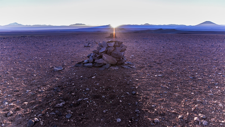
High in the Atacama Desert of Chile, a system of stone pillars and rock piles called saywas was recently found to be an ancient Inca calendar. Once thought only to mark a local Inca trail, a team of archaeologists, astronomers, historians, and researchers recently showed how the saywas work as a complicated and connected calendar to identify and predict equinoxes, solstices, and other astronomical events. The Inca trail in the Atacama Desert is part of the Qhapaq Ñan, an extensive Inca road network that stretches from southern Colombia to central Chile.

Researchers supported by ALMA identify Inca calendar in the Atacama Desert. Credit: A. Silber, ALMA/ESO/NAOJ/NRAO

The sun peeks over the Andes Mountains at dawn, illuminating a line of ancient Inca saywas in the Atacama Desert of northern Chile. Credit: A. Silber, ALMA/ESO/NAOJ/NRAO

Working at 13,800 feet (4,200 meters) above sea level in the desert mountains near Taltal, a small city in northern Chile, the scientific team began visiting the saywas and taking measurements in 2017. The team included local indigenous people as well as experts from the Chilean Museum of Pre-Colombian Art, the nearby Atacama Large Millimeter/submillimeter Array (ALMA) observatory, and the European Southern Observatory. The research was funded by BHP/Minera Escondida, a mining company with more material interests in the desert.

The scientific team began the study by documenting alignments between certain saywas and the sunrises on the March equinox and June solstice. They then began connecting saywa points with other important dates on the ancient Inca calendar. Operating much in the same way as Stonehenge in England, the saywas align with sunrises on certain dates, while also projecting shadows on the ground that lead to other stone points. The researchers also found that certain saywas align with constellations at night, further strengthening the researchers’ conclusion, published in 2018, that the network of stones served as a large calendar for Inca astronomers.

The first written accounts of the saywas were recorded during the Spanish conquest of Andean  South America in the 1500′s and 1600′s. The saywas’ remote locations in the empty desert, far from Inca cities, led the Spanish to believe that the stone piles were little more than pathway markers to help guide people through the vast, barren desert. The saywas did in fact aid in navigation, but the larger purpose of the stone markers remained unknown for centuries. In recent years, however, knowledge of the Inca has greatly expanded, and the study of ancient Quechua and Aymara (Inca languages) dictionaries led to the examination of the relationship between the saywas and the Inca astronomical system.

The ancient Inca capital of Cusco (in modern-day Peru) was surrounded by columns used to measure time, create calendars, and predict equinoxes and solstices as well as the planting and harvesting seasons. The remote saywas, however, were tucked away in the Atacama Desert. Perhaps that was merely the best view of the heavens, allowing Inca astronomers to get the most accurate measurements while Cusco was obscured by clouds and mist. Modern astronomers use the high desert for the same purpose. The sprawling ALMA observatory is only a (figurative) stone’s throw away.

Tags: alma observatory, archaeology, astronomy, atacama desert, calendar, chile, inca, saywa, south america
Posted in Ancient People, Arts & Entertainment, Current Events, Education, Environment, History, People, Science | Comments Off

Bogotá 480

Tuesday, August 7th, 2018

August 7, 2018

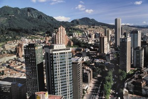
Yesterday, on August 6, Bogotá, Colombia’s capital and largest city, celebrated the 480th anniversary of its founding in 1538. One of the oldest cities founded by Europeans in South America, Bogotá is also one of the biggest. Some 8 million people call the city home. Bogotá hosts a birthday carnival every year on August 5 and 6, a raucous celebration of the city’s—and the nation’s—cultural and musical diversity.

Bogotá, the capital and largest city of Colombia, lies in a basin high in the Andes Mountains. Steep mountains rise east of the city, providing a dramatic setting. High-rise office buildings and treelined streets grace the city center. Credit: © Stone from Getty Images

Bogotá sits high in the Andes Mountains of central Colombia. The city was founded 480 years ago on Aug. 6, 1538. Credit: © Stone from Getty Images

Bogotá’s birthday carnival centers on the city’s Simón Bolívar Park, and parades teeming with dancers and musicians in vibrant costumes spiral into the nearby streets. Aromas of ajiaco—the city’s traditional chicken and potato soup—compete with stuffed arepas and empanadas for revelers’ culinary attentions. The Bogotá Philharmonic Orchestra plays a more subdued free concert in the city’s main square, the Plaza de Bolívar, and individual parties take place in every barrio (neighborhood). At sunset, fireworks erupt from atop the 643-foot- (196-meter-) high Torre Colpatria, Colombia’s tallest completed building. The south tower of the nearby BD Bacatá complex (scheduled to open later this year) looks down on the Colpatria by about 210 feet (64 meters). Bacatá is the Muisca Indian word for the region that gave Bogotá its name.

Bogotá was founded as Santa Fe de Bogotá in 1538 by Gonzalo Jiménez de Quesada, a Spanish military leader who conquered the area’s Muisca and Chibcha Indians. In the early 1700′s, the city became the capital of the Viceroyalty of New Granada. The viceroyalty consisted of what are now Colombia, Venezuela, Ecuador, and Panama. In 1830, Bogotá became the capital of independent New Granada, later renamed Colombia.

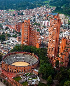
Bogotá is the capital and largest city of Colombia. The Santamaría bullring, shown here, is one of the city's Bogotá's key points of interest. The Park Towers, designed by Colombian architect Rogelio Salmona, rise beside the bullring. Credit: © Jess Kraft, Shutterstock

The Santamaría bullring, shown here, is one of Bogotá’s key points of interest. The Park Towers, designed by Colombian architect Rogelio Salmona, rise beside the bullring. Credit: © Jess Kraft, Shutterstock

Bogotá lies on a plateau about 8,660 feet (2,640 meters) above sea level, in the Andes Mountains in central Colombia. The steep mountains that surround much of Bogotá give the city a dramatic physical setting. One peak is crowned with a figure of Jesus Christ, another with a cross, and a third with a shining white convent. Cable cars travel between the city and the top of Monserrate, a mountain that is a popular observation point. A mansion at the foot of the mountain once belonged to the South American general Simón Bolívar. It is now a museum that displays items relating to Bolívar and South America’s struggle for independence.

At the center of Bogotá is the Plaza de Bolívar. It is surrounded by historic buildings, including the Cathedral; the Archbishop’s Palace; Liévano Palace, which houses the mayor’s office; and the Capitol. Nearby, mansions from the Spanish colonial era, which lasted from the 1500′s to the early 1800′s, line the narrow streets. The Gold Museum has a collection of about 35,000 gold works of art crafted by Indians before the Spaniards arrived.

Tags: bogotá, colombia, gonzalo jimenez de quesada, south america
Posted in Ancient People, Current Events, Government & Politics, History, Holidays/Celebrations, People | Comments Off

Language Monday: Quechua

Monday, August 6th, 2018

August 6, 2018

About 8 million people in Andean South America speak one of the many dialects of the Native American language Quechua. Quechua, or Runa Simi as it is called by its speakers, is commonly heard in Peru and in parts of Argentina, Bolivia, Chile, Colombia, and Ecuador. Spanish is the official language of these nations, but Quechua has equal status in Peru. Quechua descends from the dominant tribal groups of the Inca empire. More than a quarter of Peru’s population speaks Quechua. In Bolivia, there are more people who speak Quechua than speak Spanish.

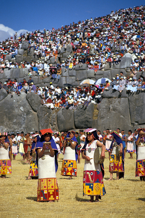
The Inca Indians ruled the largest empire in the New World. The most magnificent of their religious ceremonies—the Festival of the Sun—is reenacted at an Inca fortress in Peru, shown here. Credit: © M. Timothy O'Keefe, Alamy Images

Quechua is an ancient dialect of the Inca empire. Many people speak the language in Peru, where Inca religious ceremonies—here, the Festival of the Sun—still take place. Credit: © M. Timothy O’Keefe, Alamy Images

Quechua originated as the language spoken by the Inca. The Inca were a native South American people who ruled one of the largest and richest empires in the Americas. The Inca empire emerged in the early A.D. 1400’s and occupied a vast region centered around the capital of Cusco, in modern-day southern Peru. The empire extended over 2,500 miles (4,020 kilometers) along the Andes Mountains. Different peoples within the empire spoke Quechua and a variety of other native languages. A second important language in the empire was Aymara, which is still heard in Bolivia and other nations.

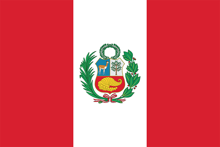
Peru flag. Credit: © Gil C, Shutterstock

The Peruvian flag flies over millions of Quechua speakers. Credit: © Gil C, Shutterstock

The Inca did not have an alphabet. They did have quipu, however, a cord with knotted strings of various lengths, colors, weaves, and designs that served as a system of record keeping. Special officials throughout the empire read the quipu and maintained the knotted strings. Archaeologists have discovered how the Inca recorded numbers and dates using quipu, but they are still trying to understand what other information might be encoded in the knotted strings.

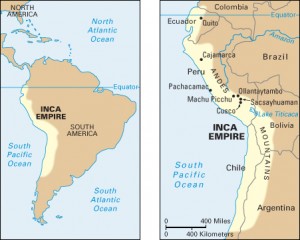
Click to view larger image The map on the left shows the location of the Inca empire along the western coast of South America. The empire included parts of what are now Colombia, Ecuador, Peru, Bolivia, Chile, and Argentina. The detailed map on the right shows some important Inca sites. These included the capital, Cusco, and its fortress, Sacsayhuaman, as well as the cities of Cajamarca, Machu Picchu, and Ollantaytambo. Credit: WORLD BOOK map

Click to view larger image
The map at left shows the location of the Inca empire along the Andes Mountains of South America. The empire’s capital, Cusco, is in modern day Peru. Credit: WORLD BOOK map

Without an alphabet or written language, information was passed along the Inca empire’s system of royal roads by messengers called chaski. Messages were passed by word of mouth or by quipu. Chaski were stationed every few miles, and messages would be passed from one messenger to the next so information would flow quickly throughout the empire.

The sons of rulers throughout the empire were sent to Cusco, where they were instructed in Inca language, history, and religion. They were also taught about the quipu and Inca fighting techniques by teachers called amauta. These teachers also recorded stories and legends in poems and songs that they retold at gatherings.

In the 1500’s, during the Spanish conquest, missionaries used Quechua to teach the Inca about Christianity. The missionaries were the first to record Quechua in written form. An official orthography—method of representing the sounds of a language by written or printed symbols—was drafted in 1939 and adopted in 1946 for the main Peruvian dialect of Quechua.

Tags: andes mountains, bolivia, native americans, peru, quechua, south america
Posted in Ancient People, Arts & Entertainment, Current Events, History, People, Religion | Comments Off

The Children of Huanchaquito

Friday, May 11th, 2018

May 11, 2018

At the end of April, Archaeologists in Peru published shocking details about an ancient site where more than 140 children were ritually killed in a human sacrifice ceremony about 550 years ago. Archaeologists consider the site, built by the Chimú culture on Peru’s northern coast, as evidence of the largest single mass child sacrifice in pre-Columbian history (the period before the arrival of Columbus in America). The site, which also includes the remains of more than 200 sacrificed llamas, is in Huanchaquito, a town near the city of Trujillo.

View of the ancient pyramid known as the Huaca del Sol in Trujillo, Peru. Credit: © Jess Kraft, Shutterstock

The remains of sacrificed children and animals were found near the ruins of the ancient city of Chan Chan, seen here before the modern buildings of Trujillo in the background. Credit: © Jess Kraft, Shutterstock

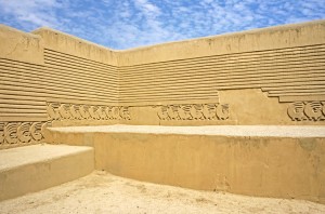
The Chimú were one of several civilizations that developed in what is now Peru beginning around 2800 B.C. The Chimú built a large capital city called Chan Chan. It was begun about A.D. 1000. Chan Chan’s ruins cover about 8 square miles (20 square kilometers) outside the present-day city of Trujillo. Experts in pre-Columbian history know that sacrifices and offerings were important in the religious ceremonies of many peoples, including the Chimú. People often sacrificed crops and animals to ensure adequate rainfall and fertile soil. Human sacrifices were made under certain circumstances, and numerous individual graves of sacrificed children have been found. The remains of the Chimú children of Huanchaquito, however, represent the first evidence of sacrifice on such a large scale. Archaeologist believe the mass child sacrifice must have been performed during a time of terrible crisis, perhaps caused by a natural disaster.

The Chimú people were among Peru's early inhabitants. This picture shows ruins of the Chimú capital of Chan Chan, begun about A.D. 1000. Chan Chan's ruins cover about 8 square miles (20 square kilometers) near present-day Trujillo. Credit: © Christopher Howey, Dreamstime

Richly decorated walls line the ruins of the Chimú capital of Chan Chan. The Chimú people were among Peru’s early inhabitants. Credit: © Christopher Howey, Dreamstime

The ceremonial site at Huanchaquito was discovered by archaeologists in 2011 as they were investigating the remains of an early Chimú temple. Archaeologists called the site Huanchaquito las Llamas because they found the skeletal remains of several llamas that had been killed as a religious sacrifice. Radiocarbon dating of remains indicated that the sacrifice occurred around A.D. 1400 to 1450. However, many ancient human remains were then also found at the site. As excavations continued, the number of human skeletal remains totaled 140 individuals. The researchers were shocked to discover that the skeletal remains were all from children aged 5 to 14. Most were between 8 and 12 years old. The llamas were young too, all less than 18 months old.

Other evidence showed that the children all died together as part of a mass human sacrifice. Forensic anthropologists observed cut marks on many of the bones. Such marks show the children were intentionally killed by other people and that they were not victims of a flood, earthquake, or other calamity. Especially telling were cut marks found on the sternum (breastbone) of many victims, along with damage to their ribs. This is evidence that the victims had their chests cut open and their hearts were violently removed. Traces of powdered cinnabar, a red mineral pigment often used in religious ceremonies, were also discovered among the bones of the child victims. The Chimú children were buried facing west toward the nearby Pacific Ocean. The llamas killed at the site were buried facing east toward the Andes Mountains. Archaeologists believe the children and animals were killed as part of the same ritual.

Archaeologists observed that the sacrifice victims were buried beneath a layer of fine mud. This evidence suggests a severe flood at the time in the otherwise arid (dry) region, perhaps caused by an unusually powerful weather event known as El Niño. In the late 1400’s, within a few decades of this mass child sacrifice, the Chimú were conquered by the expanding Inca civilization.

Before Huanchaquito, the largest known mass child sacrifice event was at the Templo Mayor in the ancient Aztec capital of Tenochtitlán (modern-day Mexico City), where the remains of 42 children were found.

Tags: ancient americas, chimu, huanchaquito, human sacrifice, inca, peru, south america
Posted in Ancient People, Current Events, History, People, Religion | Comments Off

New Clues on Ancient Beringians

Friday, January 19th, 2018

January 19, 2018

How and when did people first reach the Americas? It is generally agreed that humans arrived in the Western Hemisphere at least 15,000 years ago. They got there by crossing Beringia, a land bridge that once connected Asia and North America. (Beringia takes its name from the Bering Strait and Sea that now cover the former land bridge.) The details of this human movement have long been a mystery. Recently, however, ancient DNA found in Alaska has helped scientists learn about the timing and circumstances of the migration.

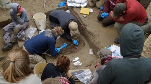
Members of the archaeology field team watch as University of Alaska Fairbanks professors Ben Potter and Josh Reuther excavate at the Upward Sun River site. Credit: © Ben Potter, University of Alaska Fairbanks

University of Alaska Fairbanks professors Ben Potter and Josh Reuther excavate the remains of two ancient infants along the Upward Sun River in Alaska. Credit: © Ben Potter, University of Alaska Fairbanks

In 2011, a team of archaeologists discovered the bones of two female infants along the Upward Sun River in Alaska. One was an infant who died a few months after birth. The other was a newborn or late-term fetus. The archaeologists determined that the infants died about 11,500 years ago. After the Upward Sun River infants died, their bodies were laid atop a bed of red ocher surrounded by antler points. Only small fragments of DNA from the younger infant were available to study. However, scientists were able to reconstruct the genome (the entire set of chemical instructions that control heredity in a human being) of the older infant.

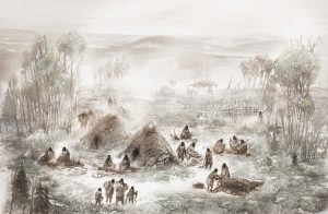
A scientific illustration of the Upward Sun River camp in what is now Interior Alaska. Credit: © Eric S. Carlson/Ben A. Potter/University of Alaska Fairbanks

This scientific illustration shows the ancient Upward Sun River camp in what is now interior Alaska. Credit: © Eric S. Carlson/Ben A. Potter/University of Alaska Fairbanks

Previous studies have shown that Native Americans are descended from one of two ancestral groups. The northern group produced most of the indigenous (native) people of Alaska and upper Canada. A southern group produced most of the indigenous people of the lower United States, Mexico, and Central and South America. The genome of the older infant revealed that she came from a very early group of Native Americans who were the ancestors of both the northern and southern indigenous groups. These original people are now known as the Ancient Beringians. The scientists’ work represents the first reconstruction of an Ancient Beringian genome. It provides key evidence to the theory that all living Native Americans are originally descended from the same group of people.

Despite the fact that the Upward Sun River infants shared a grave and seem to have been from the same community, their DNA shows a great deal of variation. This variation supports what is known as the Beringian Standstill hypothesis, which suggests that ancient Siberians entered Beringia and stayed there for thousands of years before they entered the Americas. This hypothesis proposes that ice age glaciers blocked their migration until about 15,000 years ago, when the glaciers began to melt and retreat. According to the Standstill hypothesis, much genetic mixing would have occurred in Beringia before movement into the Americas began. This helps explain why the two infants’ DNA shows such variation.

The remains of the Upward Sun River infants have shed much light on the migration of the Ancient Beringians. However, more ancient DNA must be gathered and studied before the Beringian Standstill hypothesis can be proven true. There are still many details about the populating of the Americas that remain a mystery.

Tags: alaska, ancient beringia, canada, migration, native americans, north america, south america
Posted in Ancient People, Current Events, History, People | Comments Off

  • Most Popular Tags

    african americans ancient greece archaeology art australia barack obama baseball bashar al-assad basketball black history month china climate change conservation earthquake european union football france global warming iraq isis japan language monday literature major league baseball mars mexico monster monday mythic monday mythology nasa new york city nobel prize presidential election russia space space exploration syria syrian civil war Terrorism ukraine united kingdom united states vladimir putin women's history month world war ii