Dorian’s Destruction in the Bahamas
Monday, September 23rd, 2019September 23, 2019
Three weeks ago, on September 1, Hurricane Dorian savaged the Bahamas, a chain of islands east of Florida in the Atlantic Ocean. In the slang of the islands, Dorian mashed up (devastated) much of Grand Bahama and the Abaco Islands in the northwestern part of the archipelago. Dorian, one of the strongest hurricanes on record to strike the Bahamas, killed at least 53 people there. That number will almost certainly skyrocket, however, as more than 600 people remain missing.

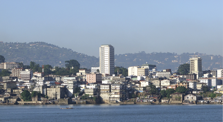
Hurricane Dorian’s high winds and floods destroyed much of Freeport, Grand Bahama, seen here on Sept. 5, 2019. Credit: © Adam DelGiudice, AFP/Getty Images
Dorian struck the Bahamas as a category 5 storm on the Saffir-simpson scale, which measures hurricane intensity. Category 5 is the strongest hurricane rating, with winds above 157 miles (252 kilometers) per hour. Hurricanes of this strength typically occur about every three years, but Dorian marked the fourth consecutive year that a category 5 hurricane has struck the Caribbean, with two striking in 2017 when Irma and Maria killed more than 3,000 people, mostly in Puerto Rico. Hurricanes of all categories can cause terrible destruction and loss of life, but category 5 hurricanes are labeled “catastrophic” by the United States National Oceanic and Atmospheric Administration (NOAA). Winds that strong will destroy most framed houses by tearing away roofs and collapsing walls. They will flatten trees and electric power poles and leave residential areas uninhabitable for weeks or months. Increases in the intensity of hurricanes and other bad weather align with what scientists expect as the world’s climate continues to change.
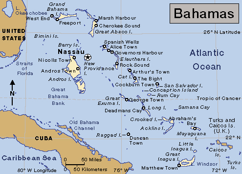
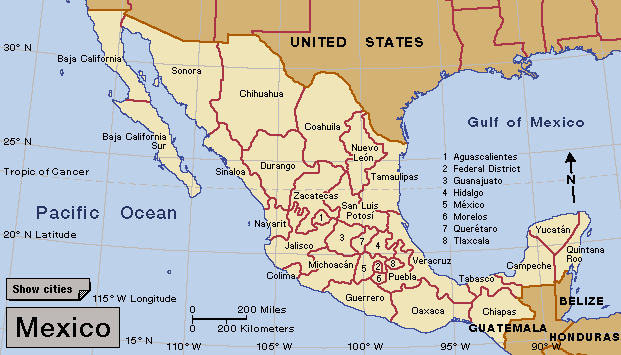
Click to view larger image
Bahamas.
Credit: WORLD BOOK map
Dorian formed as a tropical depression over the Atlantic Ocean on August 24. A tropical depression is a low-pressure area surrounded by winds that have begun to blow in a circular pattern. Dorian developed into a hurricane four days later. The storm rapidly gained size and strength, reaching category 5 status by September 1. That day, the massive hurricane hit Elbow Cay and Great Abaco Island before moving on to Grand Bahama, where Dorian lingered for more than 24 devastating hours. Dorian lashed the islands with sustained winds of 185 miles (300 kilometers) per hour and gusts over 220 miles (350 kilometers) per hour. Storm surges (sudden onrushes of seawater) and torrential rains caused deadly flooding in many parts of the low-lying islands.
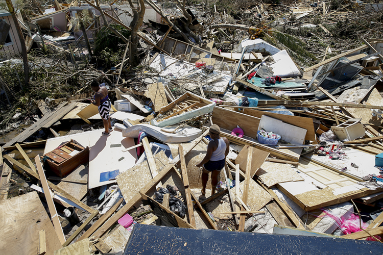
On Sept. 5, 2019, people search through the ruins of their home in Marsh Harbour, Great Abaco Island, days after Hurricane Dorian hit as a category 5 storm. Credit: © Jose Jimenez, Getty Images
Dorian then spun away along the coasts of eastern Florida, Georgia, and South Carolina, greatly diminishing to a category 1—but still dangerous—hurricane before hitting Cape Hatteras in North Carolina’s Outer Banks on September 6. From there, Dorian further downgraded to an extratropical cyclone (a stormy low pressure system) and raced northward off the U.S. east coast. On September 7, Dorian’s final gasp brought heavy rains and fierce winds to Newfoundland and Nova Scotia in Canada. The storm at last dissipated near Greenland on September 10.
Dorian threatened many areas, and states of emergency were declared in several Caribbean and Atlantic islands and eastern U.S. states. But the storm’s rapid degradation after striking the Bahamas greatly reduced its deadliness. Dorian still killed people—directly or indirectly—outside the Bahamas, however, including one person in Puerto Rico, six people in Florida, and three people in North Carolina. Direct deaths are caused by such things as blown debris, flooding, or falling trees. Indirect deaths include people who die by accident or heart attacks while involved in storm-related activities, such as clearing trees or boarding up houses. They also include those who die in car accidents trying to evacuate.