
Stonehenge Reconsidered
Friday, September 12th, 2014September 12, 2014
Recent studies done at Stonehenge uncovered buried features of which modern scholars had been unaware. (© Bryan Busovicki, Shutterstock)
European researchers have been using ground-penetrating radar and other advanced imaging techniques to “see” underground and map the landscape surrounding Stonehenge in unprecedented detail. This work has revealed long-buried features showing that the iconic megalithic monument (structure made of large stones by prehistoric people) was part of a much larger ceremonial center. The investigation, led by scientists from universities in the United Kingdom and Austria, revealed hidden features belonging to as many as 60 other prehistoric structures surrounding the site. These features include 17 small henge-like shrines, 20 burial pits, and 4 burial mounds over an area of more than 4.5 square miles (11.6 square kilometers). The new findings from the four-year survey will allow researchers to reconstruct how Stonehenge, built in 3100 B.C., was used by ancient peoples for the next 1,500 years; the site was abandoned in about 1600 B.C.
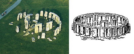
Stonehenge was probably used as a ceremonial gathering place and a religious center. It was built and used between about 3100 and 1600 B.C. The drawing shows what scholars believe was the original arrangement of the monument’s huge stones. (Aerofilms)
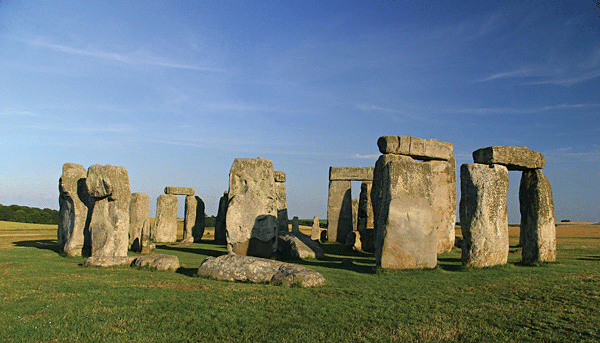
Stonehenge, on the Salisbury Plain in Wiltshire, southwestern England, consists of huge, rough-cut stones set in a circle. A huge circle of dark volcanic bluestones, weighing up to 4 tons (3.6 metric tons), is surrounded by a ring of huge gray sandstones, weighing up to 25 tons (23 metric tons) and standing up to 131/2 feet (4.1 meters) tall. The outer circle surrounding the bluestones measures 108 feet (33 meters) in diameter. Its center contained five archlike stone settings, called trilithons (two large stone posts set vertically, with a horizontal stone set across the top.) There was also a large altar stone at the center. A paved avenue once connected the site to the nearby Avon River. A similar avenue runs from the river to Durrington Walls, a large monument about 2 miles (3 kilometers) from Stonehenge.
The survey discovered underground traces of some 60 huge stones pillars up to 9-feet (3-meters) long beneath the mounds at Durrington Walls. These stones were arranged into an enormous henge (circle) nearly 1 mile (1.5 kilometers) in diameter. This “super henge” dwarfs the stone circle at Stonehenge and is the largest megalithic monument of its kind in the world. Ground-penetrating radar images of one of the mounds at Stonehenge revealed remains of a timber building over 100-feet (33-meters) long that was probably used for funeral rites.
The modern underground survey and mapping techniques demonstrate that scholars still have much to learn about Stonehenge and surrounding ancient sites. Scientists think that the Stonehenge and Durrington Walls formed a huge complex of temples, shrines, burial sites, and processional walkways that were used together for religious ceremonies.
Additional World Book articles:

