New Zealand’s Deadly Volcano
Friday, December 27th, 2019December 27, 2019
A little more than two weeks ago, on December 9, the violent eruption of a volcano on New Zealand’s White Island killed 19 people and severely injured many more. Also known also by its Māori name, Whakaari, White Island is normally uninhabited. It is a popular tourist destination, however, and all of the volcano victims were people visiting the island for the day.
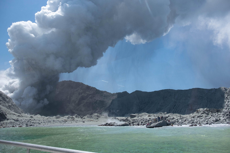
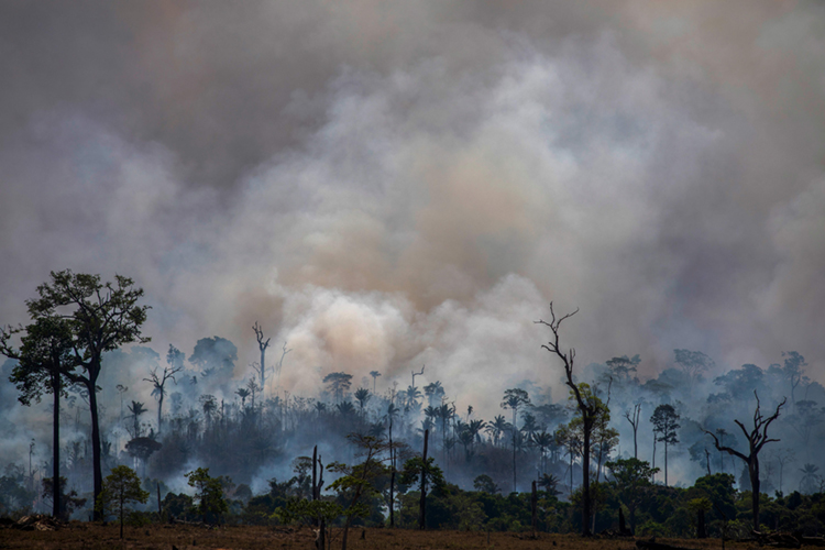
Ash, gas, and smoke billow from a volcanic eruption on White Island off the northern coast of New Zealand on Dec. 9, 2019. Credit: © Michael Schade
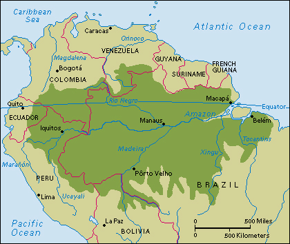
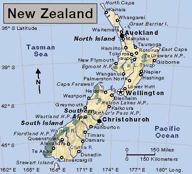
White Island is in the Bay of Plenty, about 30 miles (50 kilometers) from the coast of New Zealand’s North Island. White Island is small, about 1 1/4 miles (2 kilometers) across. The island is the peak of an underwater volcano that rises around 5,200 feet (1,600 meters) from the sea floor. The volcano is extremely active. It has vented gas almost continuously for its recorded history. The volcano also undergoes more violent eruptions spewing lava, ash, and pyroclastic flows (clouds of hot ash and gas that travel mostly along the ground). White Island became popular with volcano scientists and tourists because it is so active and fairly easy to reach.
Click to view larger image
New Zealand.
Credit: WORLD BOOK map
On December 9, the day of the eruption, 47 people were visiting White Island. The volcano erupted with a violent explosion just after 2 p.m. local time, spewing deadly ash and gas some 12,000 feet (3,700 meters) into the air. Soon after the eruption, tourist boats and helicopters rescued many people from the island, but several people had already died and many others had suffered bad burns and other injuries. Of those rescued, three died from their injuries in the days following the eruption. Fifteen of the dead were from Australia. The other four were from New Zealand and the United States.
The British explorer James Cook became the first European to spot White Island, in 1769. The name he gave it may refer to white clouds of volcanic steam rising from the island, or it may refer to a thick, white covering of sea bird guano (waste). A sulfur mine operated on the island from 1885 until 1914, when 12 people died in a landslide at the volcano’s crater. A later mining camp was also abandoned and its remains now serve as a tourist attraction. Thousands of people visit White Island each year, but tourism was suspended after the eruption, pending the results of an investigation into the health and safety practices of tour companies and visitors.