Melting Greenland
Friday, September 6th, 2019September 6, 2019
This summer, unusually warm air temperatures have caused record ice melt in the North Atlantic Ocean island of Greenland. During the month of July alone, the island lost more ice than it normally does in an entire year. In just a five-day period, from July 30 to August 3, the island lost about 90 percent of the surface of its ice sheet (a massive glacier)—an estimated 55 billion tons (50 billion metric tons) of ice. The record ice loss is a result of global warming and climate change.
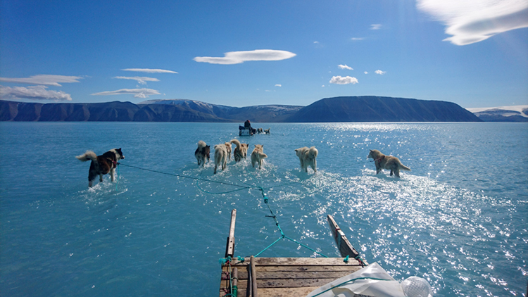
A Danish meteorological team travels across submerged sea ice in Greenland’s Inglefield Bredning fjord on June 13, 2019. The area is normally covered with ice and snow. Credit: Steffen M. Olsen, Danish Meteorological Institute
At the highest point of the Greenland Ice Sheet, 10,550 feet (3,216 meters) above sea level, temperatures topped freezing (32 °F or 0 °C) for more than 16 hours during July 30 and 31, melting some 12.5 billion tons (11.3 billion metric tons) of ice during that brief period. It was the first time ice had melted at that high point since July 2012, and it was just the third such ice melt there in the last 700 years.
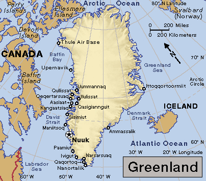
Click to view larger image. Greenland, a self-governing territory of Denmark, stretches from the Arctic to the North Atlantic Ocean. Credit: WORLD BOOK map
The ice sheet that covers Greenland is about the size of Alaska, and it contains enough ice to raise global sea levels by more than 20 feet (6 meters). During an average summer, Greenland will lose some ice from meltwater and from icebergs that calve (break off) into the ocean. But the ice loss typically happens at the sheet’s edges at sea level—not at the highest and coldest points. The amount of ice loss is also normally much less. From 1981 to 2010, the average ice melt from July 30 to August 3 was 15 billion tons (13.6 billion metric tons).

Huge icebergs form where the Jakobshavn Glacier flows into the sea near Ilulissat, Greenland. Credit: © Radius Images, Getty Images
The drastic summer ice melt in Greenland is a continuation of an alarming and worsening trend. In 1972, Landsat satellites (a project then known as the Earth Resources Technology Satellite) began photographing and mapping Greenland’s ice sheet. Landsat, a joint mission of NASA and the United States Geological Survey, uses a series of satellites to produce detailed images of Earth from space.
From 1979 to 2006, satellite images showed a 30 percent rise in the amount of Greenland ice that melts each summer, and the ice loss continues to increase. Greenland’s ice fronts have drastically retreated, rocky peaks have become exposed, and the size and shape of the island’s many fiords have changed significantly. In August 2019, Landsat images showed wet snow and melt ponds at Greenland’s higher elevations, and large parts of the island’s shrinking glaciers appeared brownish grey. The color indicates that the surface has melted, a process that concentrates dust and rock particles and leads to a darker recrystallized ice sheet surface.
Greenland is not the only site of rapidly increasing ice melt. Warmer global temperatures are reducing glaciers and ice fields in the Arctic and Antarctica, as well as in Iceland, the Alps, the Andes, the Himalaya, the Rockies, at Kilimanjaro in Tanzania, and in the Sudirman Range in Indonesia.